Description
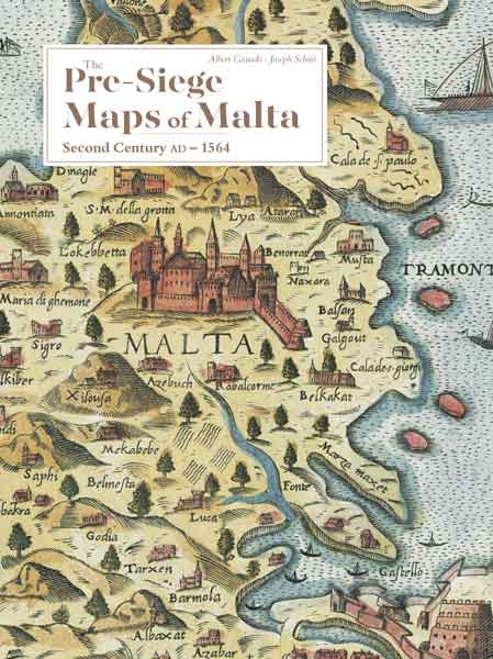
The first separate map of Malta goes back to the last quarter of the fifteenth century which proves the importance of Malta at the centre of the inland sea notwithstanding its extremely small size. It was a vital focal point for navigators and a seaward bridge between Sicily and the Barbary States.
However, it was only in the sixteenth century that Malta acquired the status of a pawn on the European chessboard. When it became the new seat of the Order of St John in 1530 after its eviction from Rhodes, the island was exposed to frequent raids by Ottoman forces and the Barbary corsairs of the fame of Barbarossa and Dragut.
The Malta Map Society thought it fit to promote the publication of a book on all the pre-siege maps of Malta on the same pattern and detail more or less followed in 1994-95 in the opus regarding the Great Siege of 1565. Hence the launch of the present book which embraces all the pre-siege separate maps of Malta, whether manuscript or printed, as well as the appearance of Malta on the maps of the Mediterranean drawn by Ptolemy in the second century AD, by Al-Idrisi in 1157, and by practically all the cartographers that came after them up to 1564.


Reviews
There are no reviews yet.